How Tall Is Mount Vesuvius
The summit of Vesuvius stands at 1,281 metres, but no visitor reaches it. The public crater trail stops at 1,175 metres, and that gap shapes every tour of the volcano.
Short answer
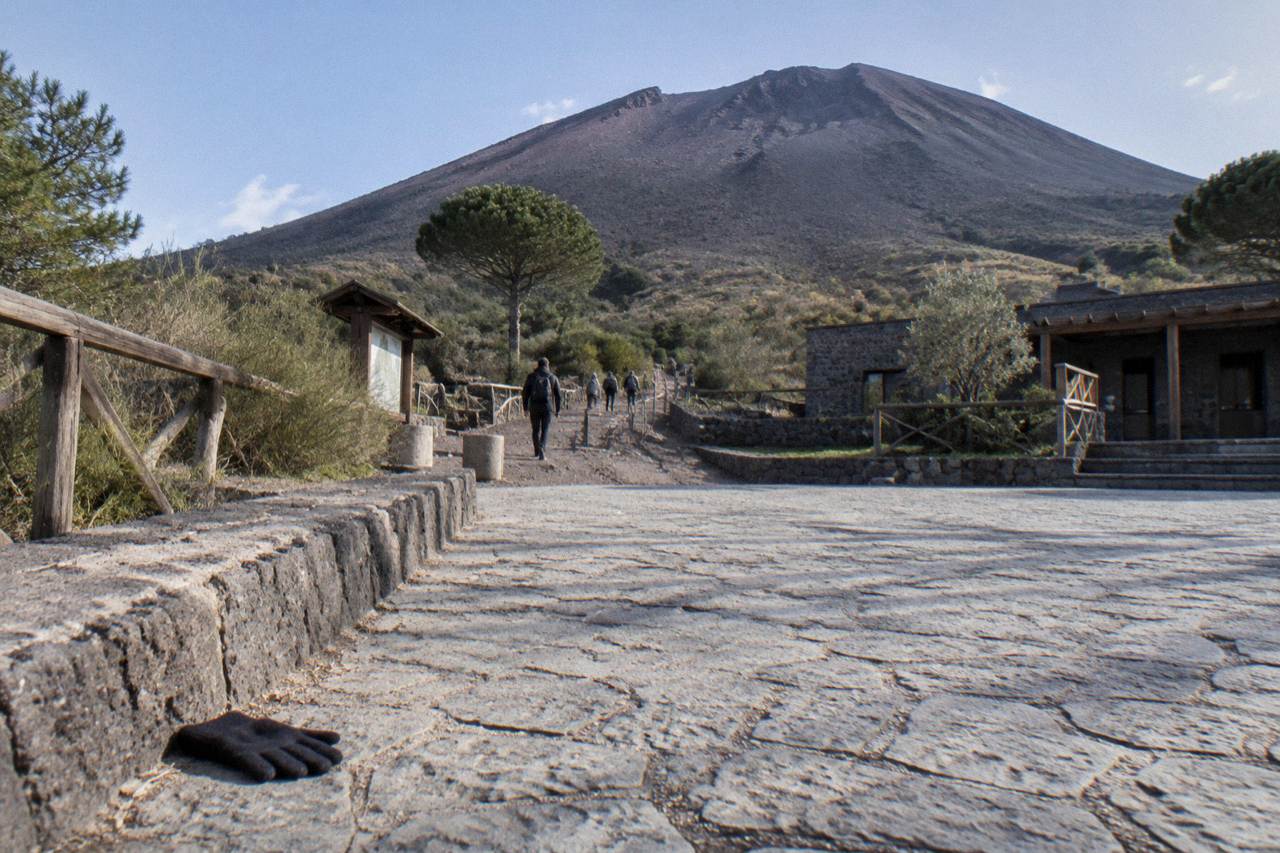
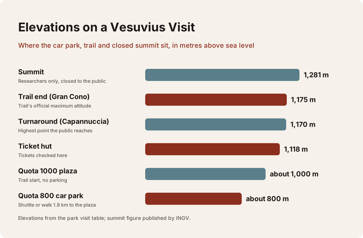
Mount Vesuvius is 1,281 metres high at its summit, the official figure published by INGV. The public crater trail, Trail 5 or the Gran Cono, tops out at 1,175 metres, so visitors do not reach the true summit. The walk starts at the Quota 1000 plaza, giving roughly 175 metres of climbing on foot.
The number people search for is simple: Vesuvius is 1,281 metres tall. The number that matters for a visit is different, because the trail everyone walks stops at 1,175 metres and the summit itself belongs to researchers, not tourists. That gap, just over 100 metres of vertical rock, is the quiet fact behind almost every confusion about the volcano's height, from "how hard is the climb" to "why does my photo not look like the postcard".
This guide sets out the official figures, traces the elevation from the car park to the crater rim, and connects the numbers to the tours that get you there. The heights come from INGV, Italy's National Institute of Geophysics and Volcanology, and from the park's own Gran Cono page, which also governs the trail rules. For a broader look at the volcano's behaviour, see the companion guide Is Mount Vesuvius Active.
How Tall Is Mount Vesuvius Exactly?
Mount Vesuvius stands 1,281 metres above sea level, the figure published by INGV for the Somma-Vesuvius volcanic complex. The crater rim is elliptical with a maximum diameter of 580 metres, and fumaroles still vent on the inner walls, reminders that the volcano is active though quiescent. The last eruption ended in March 1944, and no eruption has occurred since.
The 1,281 m figure is the summit of the Gran Cono, the young inner cone that grew inside the older Mount Somma caldera after the AD 79 eruption destroyed much of the original mountain. That ancient eruption, traditionally dated August 24, though a 2018 find points to October, blew the top off the older edifice and left the nested structure visitors see today: an outer horseshoe of Somma, and the inner cone of Vesuvius proper.
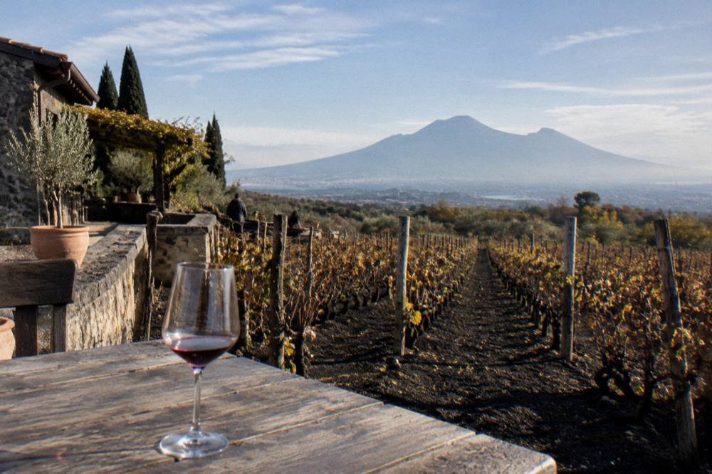
A point that surprises many readers: the classic view of "the volcano" from Naples or the bay is mostly this compound shape, not a single cone. The height you measure depends on where you start, and geologists measure from sea level. For the eruptive story behind the current shape, see When Mount Vesuvius Last Erupted.
Why Doesn't The Trail Reach The Summit?
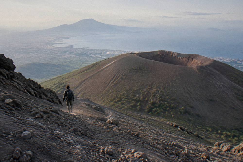
The public crater trail, Trail 5 or the Gran Cono, tops out at 1,175 metres, just over 100 metres below the 1,281 m summit. The upper rim route is closed to the public and reserved for researchers, so no tour, at any price, takes visitors to the true summit. Every visitor's highest point is the turnaround zone at about 1,170 metres near the crater edge.
The park's rules are explicit on this. The trail runs from the Quota 1000 plaza up a well-made path; the ticket hut sits at 1,118 metres and the "Capannuccia" turnaround at 1,170 metres. Beyond that, the upper rim path is interdetto, off limits, partly for safety and partly to protect a fragile scientific zone. The closure is standing policy, not a seasonal suspension.
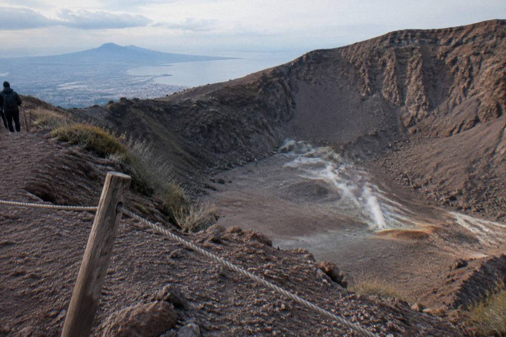
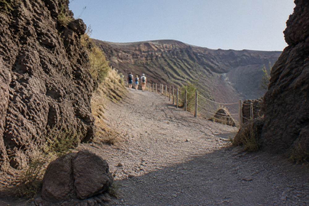
This is worth internalising before you book anything marketed as a "summit experience". Operators honestly describe their products as crater hikes, and the view from 1,175 metres is genuinely the view: you look directly into the elliptical crater, 580 metres across at its widest, with fumaroles steaming on the far inner wall. If you want to compare formats, start with the semiprivate Sorrento Vesuvius tour, which pairs a train leg with a minibus to the plaza.
How Much Climbing Do You Actually Do On Foot?
Counting from the Quota 1000 plaza at about 1,000 metres to the trail end at 1,175 metres, a visitor climbs roughly 175 metres on foot, a derived figure rather than an official one. The round trip is 4,010 metres long and takes about 2 hours 30 minutes. The park rates the difficulty as low: steadily uphill, short and manageable.
That 175 m is the honest answer to "how high do I climb", and it reframes the trip. You are not scaling a 1,281 m mountain; you are walking the top fifth of it, on a path built for exactly that purpose. The surface is loose volcanic gravel in places, so worn trainers cope but sturdy shoes are better, and one guest review of the big Naples day tour put it plainly: "Very uneven surfaces and very hot in summer so trainers and water bottles."
| Point on the visit | Elevation | What happens there |
|---|---|---|
| Quota 800 car park | about 800 m | Park here, then shuttle or walk 1.8 km to the plaza |
| Shuttle between quotas | 800 to 1,000 m | Ercolano shuttle, €1 each way, about 4 minutes |
| Quota 1000 plaza | about 1,000 m | Trail start, no parking, no public toilets temporarily |
| Ticket hut | 1,118 m | Tickets checked here |
| Turnaround ("Capannuccia") | 1,170 m | Highest point the public reaches |
| Trail end overall | 1,175 m | Trail's official maximum altitude |
| Summit | 1,281 m | Researchers only, closed to the public |
If arriving by car you add a further stretch: from the A3 exit at Torre del Greco, the SP144 brings you to the Quota 800 car park in about 15 minutes, 7.3 km, and from there it is roughly 30 minutes on foot to the plaza if you skip the shuttle. That lower stretch is paved road, not trail, so it adds distance more than effort, but families and anyone with knee trouble usually prefer the €1 shuttle for the uphill direction. Full logistics live in our guide to shuttle buses and parking.
Is 1,175 Metres Still A Big View?
Yes. From the trail end at 1,175 metres you stand directly on the crater rim of an active volcano, looking into a crater up to 580 metres across, with the entire Bay of Naples, Capri, the Sorrento peninsula and the Apennines laid out below. On clear days the visibility runs for tens of kilometres in every direction.
The view is the product, and the elevation delivers it. Because the cone rises from a coastal plain, the drop from rim to sea is nearly the full height of the mountain in one sweep, which is why the panorama photographs so well. What the height cannot guarantee is clarity: haze, cloud cap and weather fronts can swallow the bay entirely, and the trail and box office close automatically on days with an orange weather alert or higher, with automatic refunds for slots inside the closure. Our guide to weather and visibility covers how to read the forecast before committing.
There is also a seasonal geometry to the view worth planning around. In the shorter months the trail's last access sits at 15:00, and sunset on 15 November comes at 16:46, so a late slot walks down in failing light. In summer, with last access at 18:00 and sunset past 20:00, you get long golden-hour shadows across the crater floor. Neither is a sunset hike in the tour-operator sense, but the clock changes what you see from the same 1,175 metres.
Visibility aside, the climb itself is accompanied. Every visitor above 1,000 metres is accompanied by the park's volcanological guides, a mandatory service run by the Presidio Permanente Vulcano Vesuvio for each group on the trail. A commercial tour therefore adds transport, timing and commentary, not permission to climb higher than everyone else.
How Much Colder Is It At 1,175 Metres?
Summit-level daytime highs run about 6 to 7 degrees Celsius below Naples every month, using the modelled 1991-2020 climate average for the 1,000 metre level. In January that means average highs near 5.6 C against 11.7 C in the city; in August, 22.8 C against 29.3 C. Wind on the exposed rim makes it feel colder still.
The practical reading: dress one season ahead of the city. A July morning that feels like shorts weather in Naples can be genuinely brisk on the gravel above the plaza, and a November visit can sit near 10 C with 13 rain-adjacent days in the month. November is the wettest summit month in the climate average, with 180 mm of rain; July is the driest, with 16 mm. The rest of the planning pages sit on Mount Vesuvius Tours.
| Month | Summit average high C | Naples average high C | Summit rain mm |
|---|---|---|---|
| January | 5.6 | 11.7 | 119 |
| April | 11.1 | 17.4 | 87 |
| July | 22.1 | 28.6 | 16 |
| October | 14.8 | 20.9 | 129 |
| November | 10.4 | 16.4 | 180 |
These are modelled climate averages, not forecasts; check the live picture before you travel, and pack a layer even in summer. Our piece on whether it is cold at the top of Vesuvius goes deeper on what to wear (see Train To Vesuvius?). Snow, for the record, is rare at these elevations, about 1.7 days a year at the 1,020 metre grid cell in the modelled average, so a winter visit is far more likely to be cold and damp than white.
Does The Height Make The Hike Hard?
For most reasonably fit visitors, no. The park's own difficulty rating for Trail 5 is low, the round trip is 2 hours 30 minutes, and the roughly 175 metres of climbing are spread over a well-graded path. The challenges are surface and sun: loose gravel underfoot and almost no shade above the tree line.
Timing rules keep groups moving: a tour may not exceed 2 hours on the shortest route and 3 hours on the longest under the park protocol, and capacity is capped at 360 hikers per hour, 60 people every 10 minutes in three groups of 20. Daily caps range from 2,160 visitors in the winter months to 3,240 in July and August. So even on a busy day the trail never feels like a queue, though the plaza can.
For anyone worried about fitness, honest framing helps: this is a walk with a view, not a mountaineering route, and our guide for less fit visitors lists the alternatives, including simply enjoying the lower park trails. If you would rather fold the crater into a relaxed day, the roster includes options like the from Naples all-inclusive half-day tour, from €44.80 per person, rated 4.5 from 891 reviews, which handles transport and ticketing in 3.5 to 4 hours.
Which Tours Actually Bring You To 1,175 Metres?
Every Vesuvius tour that includes the Gran Cono ends at the same 1,175 metre trail top, because the route above the plaza is single and shared. Tours differ in how you get to the plaza: shared shuttle, guided hike with transport, or a transfer-and-ticket package. The cheapest formats bundle bus plus park entry from about €35.10 per person.
The comparison worth making is between format and price. A bare transfer such as the Mount Vesuvius Tour from Pompeii, from €35.10 per person and rated 4.2 from 59 reviews, moves you from Pompeii to the plaza with entry handled. A guided option like the expert-guided Pompeii Vesuvius tour, from €65 per person, rated 4.8 from 242 reviews, adds a hiking guide who explains the vulcanology on the way up.
| Tour (decision name) | From price | Rating and reviews | Duration |
|---|---|---|---|
| Direct Transfer, Guaranteed Entry | from €35.10 per person | 4.4 from 1,785 reviews | 3 hours |
| Expert Hiking Guide From Pompeii | from €65 per person | 4.8 from 242 reviews | 3 hours approx. |
| Half-Day Volcano Trip From Naples | from €44.80 per person | 4.5 from 891 reviews | 3.5 to 4 hours |
| Semiprivate, Train and Minibus | from €65 per person | 4.1 from 60 reviews | 4 hours |
The Sorrento semiprivate option in that table, run with train and minibus legs, is a good middle format for readers based on the peninsula; it is bookable for future dates, so confirm the operator's current schedule on the live listing. Rome-based readers have a longer runway: the transfer-and-ticket product from Rome, Naples or Pompeii starts from €25 per person, rated 4.3 from 826 reviews, and runs 4 hours to a full day depending on the start point, which shows how much of any Vesuvius day is simply getting to the mountain rather than up it.
How Does 1,281 Metres Compare With Other Famous Volcanoes?
Vesuvius is a modest mountain by global standards: 1,281 metres puts it far below the great stratovolcanoes, and even within Italy it is dwarfed by Etna. Its fame rests on location and history, not altitude. The volcano sits above a red zone of about 700,000 residents across 25 municipalities, the population that evacuation plans must move.
That density is the real measure of Vesuvius. The regional civil protection plan defines a red zone covering 25 municipalities in the provinces of Naples and Salerno, with about 700,000 residents to be evacuated in a crisis, per Regione Campania Civil Protection. Height is a footnote to that exposure; the monitoring network is the headline, and the alert level is published as green, with the September bulletin recording 121 small earthquakes, maximum magnitude 1.7.
For the scenario-minded reader, Would Naples Be Destroyed If Vesuvius Erupted? works through the exposure question in detail, and it is a fair follow-up once you grasp how many people live on the slopes below the 1,281 m marker.
Is The Height Still Changing?
The summit figure of 1,281 metres is effectively stable in human terms; erosion and minor ground deformation move it by millimetres, not metres. The cone's shape was set by the 1944 eruption, the last to date. What does change continuously is the crater's inner profile, reshaped by fumarole activity and rockfall inside the rim.
Monitoring backs this up. The Osservatorio Vesuviano reports no magmatic deformation and a long-term decline in hydrothermal activity in the crater, with the current status page publishing the alert level and monthly bulletin. So while the number 1,281 will stay in guidebooks for decades, the volcano beneath it is watched around the clock, which is more than can be said for most mountains of its size.
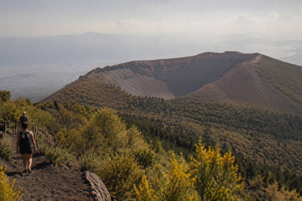
One height-related subtlety: because the public trail ends at 1,175 metres and the rim path beyond is closed, no visitor's GPS watch will ever log the official summit. If you see a tour promising "the very top of Vesuvius", read the itinerary carefully; honest listings say crater rim, Gran Cono or trail 5. When in doubt, check the listing for what entry and route are included.
What Should You Take From The Height Figures?
Remember three numbers and you understand the mountain as a visitor: 1,281 metres is the summit nobody reaches, 1,175 metres is where the trail ends and everyone's photo is taken, and roughly 175 metres is the honest climb from the Quota 1000 plaza. Everything else, shuttles, tickets and guides, exists to deliver you to that rim.
Booking follows from that. Tickets for the Gran Cono are sold only online by time slot, 50 per 10-minute slot, released 30 days ahead, and the park's authorised online seller shows €11.68 full price against the park's own ticketing-rules figure of €10; reduced rates are €8, or €9.55 online, for under 25s and residents of the 13 park municipalities. Bundled tours fold that entry into the fare where the listing says so.
The choice of product then comes down to where you start and how much structure you want, whether that is a bare transfer from Pompeii, a guided three-hour hike, or a full Pompeii-and-crater day. Whatever you pick, the mountain will do its part: the same 1,281 metres of volcano, and the same rim at 1,175 metres where the public story of Vesuvius has always ended.
Common Questions About The Height Of Mount Vesuvius
How tall is Mount Vesuvius in feet?
The official INGV figure is 1,281 metres above sea level. For visitors the more useful number is the trail end at 1,175 metres, the highest point the public reaches on the crater path.
Can you reach the actual summit of Vesuvius?
No. The upper rim route above the trail end at 1,175 metres is closed to the public and reserved for researchers. Every tour, guided or self-guided, turns around at the same point near the crater edge at about 1,170 metres.
How much elevation gain is the Vesuvius hike?
Counting from the Quota 1000 plaza, the climb is roughly 175 metres on foot to the trail end, a derived figure rather than an official one. The round trip is 4,010 metres long and takes about 2 hours 30 minutes at a modest pace.
Is Vesuvius the tallest volcano in Italy?
No. Vesuvius, at 1,281 metres, is well below Etna in Sicily, which is far taller and is Europe's most active volcano. Vesuvius is famous for its history and its setting above the Bay of Naples, not for its altitude.
Does the height of Vesuvius change over time?
Not measurably in human terms. The summit figure of 1,281 metres is stable, and monitoring shows no magmatic deformation. The crater's inner walls continue to change subtly through fumarole activity and rockfall, but the official height has not shifted.