When Mount Vesuvius Last Erupted
Mount Vesuvius last erupted in March 1944, and the deep, steaming crater hikers look into today is that eruption's direct product. Here is what happened that week, what the rim shows now, and how to stand on it.
Short answer
Mount Vesuvius last erupted in March 1944. The eruption began on 18 March, intensified on 19 March, and lava reached the towns on the volcano's flanks on 21 March, per the INGV Osservatorio Vesuviano. No eruption has occurred since. The volcano is published at green alert level, and the September 2026 bulletin recorded 121 small earthquakes.
Mount Vesuvius last erupted in March 1944, and the crater that eruption left behind is the one every hiker looks into today. The volcano has been quiet for more than eight decades, but it is quiet the way a sleeping animal is quiet: monitored around the clock, fenced in by ticketing rules, and walked only alongside the park's own volcanological guides. This page sets out what the official record says happened in 1944, what the rim shows a visitor standing on it now, and how the trips sold from Pompeii and Naples, including the Mount Vesuvius Tour from Pompeii, put you on that exact ground. If you're still sorting out how the volcano relates to Naples, Pompeii, and the bay around them, the guide to Mount Vesuvius and its surroundings lays out the geography before you plan the climb.
When Did Mount Vesuvius Last Erupt?
Mount Vesuvius last erupted in March 1944, and no eruption has followed it. The INGV Osservatorio Vesuviano records that the eruption began on 18 March 1944, grew more intense on 19 March, and sent lava toward the surrounding towns on 21 March. Every crater walk sold today crosses ground that this eruption created. If you're curious how much climbing those crater walks actually involve, the guide to Mount Vesuvius's real height tells you what to expect on the way up.
The source for those three dates is not a legend or a popular retelling. It is the Osservatorio Vesuviano's own 1944 eruption page, the historical record kept by the institute that has watched the volcano longer than anyone else. The observatory describes the eruption as the volcano's last: activity began on 18 March with an explosion that partly destroyed the small scoria cone inside the crater, intensified on 19 March, and by 21 March the lava had reached the towns on the mountain's flanks.
That makes 1944 the closing chapter of an eruptive cycle, not a one-off. For context, the eruption most people picture when they hear the word Vesuvius is the AD 79 event that buried Pompeii and Herculaneum, traditionally dated to 24 August though a 2018 find at Pompeii points to October. The full story of that eruption is covered in The 79 AD Eruption Of Mount Vesuvius. What matters here is the sequence: a famous catastrophic eruption in antiquity, nearly nineteen centuries of smaller activity, and then silence since 1944.
| Date in March 1944 | Phase | What the official record states |
|---|---|---|
| 18 March | Opening | Explosive activity begins; explosions partly destroy the intracrater scoria cone |
| 19 March | Intensification | Activity grows more intense |
| 21 March | Lava reaches the towns | Lava flows reach settlements on the volcano's flanks |
| After March 1944 | Quiescence | No further eruption; alert level published as green |
What Happened During The 1944 Eruption Of Vesuvius?
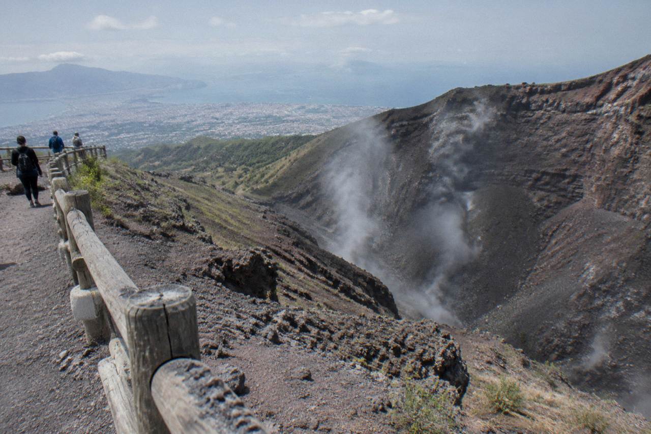
The 1944 eruption unfolded across roughly one week in March. Explosions on 18 March tore open the small cone that had built itself inside the crater, activity intensified sharply on 19 March, and by 21 March lava had reached the towns on the flanks. The eruption then subsided, leaving the deep, steaming crater that visitors see from the rim today.
Three days do the heavy lifting in the record, but they describe a real escalation. On 18 March the explosion partly destroyed the intracrater scoria cone, the pile of loose volcanic fragments that had accumulated inside the vent during the quiet years. On 19 March the activity became more intense. On 21 March the lava reached the towns. The observatory's account stops there, and this page stops there too: no casualty or damage figures appear in the verified record, and none will be invented here.
What followed the eruption matters more to a visitor than the eruption itself. The vent settled into quiescence, the crater deepened into its present elliptical shape, and the fumaroles that had vented during the crisis settled into the inner walls, where they still release volcanic gas today. The volcano the world inherited after March 1944 is the one now managed as a national park, its crater path ticketed by the hour and its slopes planted with the vineyards that produce Lacryma Christi wine.
That is also why the eruption is easier to "visit" than most people expect. The 1944 lava and the crater it reshaped sit directly on the standard tourist route from the Bay of Naples, and operators run the logistics daily. The trio below covers the three most useful ways in: the straightforward bus-and-ticket trip from Pompeii, a guided volcano hike from the same town, and the long combined day trip from Rome for travelers based in the capital.
Is Mount Vesuvius Still Considered An Active Volcano?
Yes. Vesuvius is an active volcano in a quiescent, or dormant, phase. The Osservatorio Vesuviano publishes the alert level as green, meaning monitoring parameters sit within base values, and its September 2026 bulletin recorded 121 small earthquakes with a maximum magnitude of 1.7. Fumaroles still vent on the crater's inner walls, in plain view of hikers on the rim.
The distinction between "active" and "erupting" trips up a lot of visitors. A volcano is active if it has erupted in the recent geological past and retains the plumbing to erupt again; Vesuvius qualifies on both counts. The park's own description calls the volcano still active, though in a phase of quiescence. Dormant is not extinct, and no serious source describes Vesuvius as extinct.
The monitoring backs that up. The observatory's current-status page publishes the alert level as green and posts a monthly seismic bulletin. The September 2026 bulletin recorded 121 earthquakes, 113 of them below magnitude 1.0 or undetermined, shallow and mostly located in the crater area, alongside a long-term decline in the volcano's hydrothermal activity. Those are the numbers of a volcano breathing slowly, not one gathering itself.
For the deeper question of what active really means for the mountain, including the monitoring network and the alert system, see Is Mount Vesuvius Active. The short version: green means ordinary, and it has meant ordinary for eighty years.
What Does The Crater Rim Show A Hiker Today?
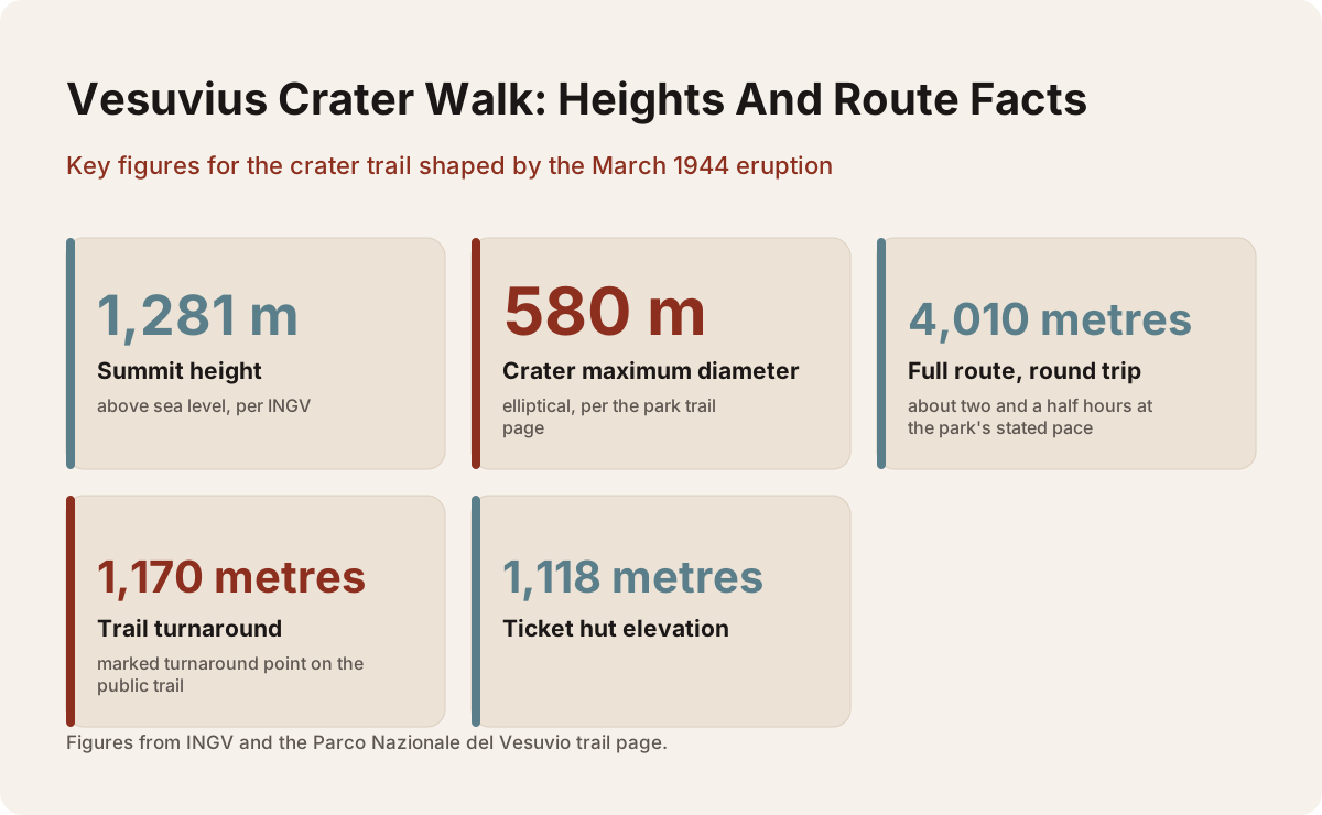
The rim shows the 1944 eruption's aftermath in physical form. The crater is elliptical with a maximum diameter of 580 metres, its inner walls vent fumaroles, and the summit stands 1,281 metres above sea level per INGV. The public trail tops out at 1,175 metres, so visitors look into the crater from a marked turnaround at 1,170 metres.
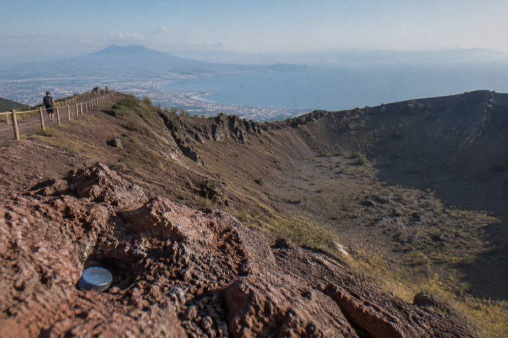
Standing on the rim, you are standing on the edge of the 1944 vent. The crater's maximum diameter of 580 metres and its elliptical shape come from the park's own trail page, and the fumaroles on the inner walls are visible, and occasionally audible, on any calm day. The upper route around the rim itself is closed to the public and reserved for researchers, so the visit is a look down into the amphitheater rather than a circuit of it.
The numbers a hiker actually walks are smaller than the headline figures. The summit's 1,281 metres belongs to the mountain, but the trail's turnaround sits at 1,170 metres, with the ticket hut at 1,118 metres and the start at the Quota 1000 plaza. The full route is 4,010 metres round trip, about two and a half hours of walking at the park's stated pace, on a path the park rates as low difficulty.
| Feature | Figure | Source |
|---|---|---|
| Summit height | 1,281 m above sea level | INGV |
| Crater maximum diameter | 580 m, elliptical | Parco Nazionale del Vesuvio |
| Trail high point (public) | 1,175 m | Park trail page |
| Turnaround point | 1,170 m ("Capannuccia") | Park trail page |
| Ticket hut | 1,118 m | Park trail page |
| Trail 5 length | 4,010 m round trip | Park trail page |
| Stated walking time | 2 h 30 round trip | Park trail page |
This is where the tours earn their price. The basic Mount Vesuvius Tour from Pompeii run by Around Vesuvio is a 3-hour bus transfer with the entry ticket included, from €35.10 per person, rated 4.2 from 59 reviews, and it exists precisely because getting from Pompeii to the Quota 1000 plaza independently is fiddly. A step up in guidance, From Pompeii: Mount Vesuvius Guided Tour with Transfer by Askos Tours, costs from €65 per person, runs 3 hours, and carries a 4.8 from 282 reviews, with a minimum age of 4 noted on the listing.
How Likely Is Another Vesuvius Eruption?
Another eruption is treated by the authorities as a matter of when, not whether, though no short-term warning signs exist today. The official red zone counts about 700,000 residents across 25 municipalities in the provinces of Naples and Salerno who would need evacuating, per Regione Campania Civil Protection. The green alert level and the long-term decline in hydrothermal activity indicate no immediate unrest.
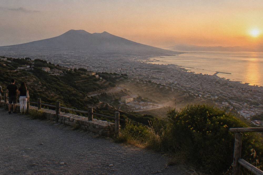
The planning documents are blunt about the stakes. The regional civil protection page on the red zone states the figure directly: roughly 700,000 inhabitants to be evacuated across 25 municipalities, up from 18 municipalities and about 550,000 in the earlier 2001 plan. That is the population that lives close enough to be inside the danger perimeter of a future eruption.
"Likely" is the wrong word for a timescale, though, and honest sources refuse to give one. Volcanoes do not run on schedules. What the monitoring gives is a detection capability: an eruption of the kind Vesuvius produces is expected to announce itself through rising seismicity, ground deformation and gas changes in the months before it breaks the surface, which is what the observatory's continuous network is built to catch.
For visitors, the practical takeaway is reassuring. Nothing in the current data, from the green alert level to the multi-year decline in hydrothermal activity, points to anything brewing. The question of what a future eruption would mean for the city of three million people around the bay is taken up in Would Naples Be Destroyed If Vesuvius Erupted?, which separates the evacuation plan from the destruction scenarios.
How Do Scientists Watch Vesuvius For Warning Signs?
Vesuvius is among the most closely monitored volcanoes on Earth. The Osservatorio Vesuviano runs continuous seismic, geodetic, thermal and geochemical networks, publishes a monthly bulletin, and states the alert level on a dedicated public page. Its September 2026 bulletin recorded 121 earthquakes, 113 of them below magnitude 1.0 or undetermined, all shallow and mostly in the crater area.
The observatory is itself a piece of eruption history. It is the oldest volcanology institute in the world, per its own record, and its instruments have watched every twitch the volcano has made through to the present monitoring network. Today it forms part of the national institute of geophysics and volcanology, INGV, which also publishes the volcano's reference height of 1,281 metres.
| Monitoring parameter | Latest published reading |
|---|---|
| Alert level | Green, parameters within base values |
| Earthquakes in the September 2026 bulletin | 121 |
| Maximum magnitude | 1.7 |
| Quakes below magnitude 1.0 or undetermined | 113 of 121 |
| Location of located events | Mostly the crater area, shallow depths |
| Hydrothermal activity | Long-term decline |
| Ground deformation | No significant magmatic deformation reported |
A maximum magnitude of 1.7 is tiny. Most people cannot feel an earthquake that small, and dozens of them a month around a dormant vent is ordinary business, the volcano's plumbing settling. What would matter is a change: sustained swarms at greater depth, rising gas flux, ground beginning to swell. None of that is in the record.
What Changed On The Mountain Since 1944?
The mountain a visitor meets today is a managed park rather than the wild cone photographed in 1944. Vesuvius is a national park with 11 numbered trails, and anyone walking above 1,000 metres must be accompanied by the park's volcanological guides. The crater route, Trail 5 or the Gran Cono, starts at the Quota 1000 plaza on the Ercolano side.
The 1944 eruption was the last act of the old mountain, and what replaced it is a designed visitor system. The park lists 11 numbered trails across the massif, from the Gran Cono crater path to forest routes on the Somma side. Only the crater route is ticketed by time slot; the others are ordinary park paths, and their statuses change with the seasons and with maintenance, so no standing open-or-closed claim belongs on a page like this.
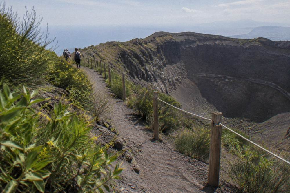
The mandatory guiding above 1,000 metres is the change most visitors feel. Every group on the crater path is accompanied by guides of the park's permanent volcano service, which means the walk comes with interpretation built in: the fumaroles, the 1944 lava, the geology of the Somma-Vesuvius complex all get narrated whether or not your tour operator brought its own guide. Hikers keep to the right side of the walkway, per the park's rules.
The logistics around the mountain industrialized too. The park's own pages describe the access system: parking along the provincial road run by the Comune di Ercolano, a shuttle between the Quota 800 car park and the Quota 1000 plaza at €1 each way, and a public EAV bus up from Pompeii. The full practical picture, trail by trail, is in How To Hike Mount Vesuvius, which compares the guided options against doing it yourself.
How Do You Visit The Crater Of The Last Eruption?
Entry to the crater trail is sold only online, by time slot, through the park's authorised seller. The park's adult ticket is €10 under its ticketing rules; the authorised online seller shows €11.68. Reduced tickets cost €8, or €9.55 online, for under 25s and residents of the 13 park municipalities, and children under 6 walk free with an adult.
The ticket mechanics are strict because the trail is capped. Slots release 30 days ahead at 50 tickets per 10-minute window, and when a day sells out, a last-minute release of 10 tickets per slot opens 30 minutes before each slot, buyable only via the wifi near the entrance, with a maximum of 5 per email address and named tickets matching ID. Twenty percent of each day's tickets are held back for that last-minute pool.
Getting there is the other half of the job. From Naples, the Circumvesuviana toward Sorrento or Poggiomarino-Via Pompei serves Ercolano Scavi, where taxis and private shuttles run up, or Pompei-Villa dei Misteri for the public bus. The EAV line 808 bus from Pompei Piazza Anfiteatro to the Quota 1000 plaza takes 55 minutes and costs €3.80 on board, with 9 departures a day each way under the timetable in force from 1 October 2026. Note the last bus up arrives at 15:25, after the winter last entry, so late starters need a different plan.
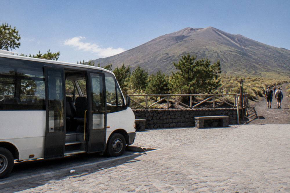
This is why transfer-and-ticket products dominate the bookings. On Mount Vesuvius Tours we compare the live listings, and the pattern is consistent: the operator buys the crater slot, runs the bus, and removes both failure points. Mount Vesuvius Transfer with Entry Tickets by Visiting Campania, a 3-hour trip from Naples with pickup, sells from €35.10 per person and carries a 4.4 from 1,785 reviews. Travelers based in Rome usually take the long day instead: From Rome: Pompeii Day Trip with Optional Vesuvius and Lunch by City Wonders runs 9 to 12 hours from €56 per person, rated 4.6 from 5,931 reviews.
| Tour | Duration | From price | Rating |
|---|---|---|---|
| Mount Vesuvius Tour from Pompeii (Around Vesuvio) | 3 hours | €35.10 per person | 4.2 from 59 reviews |
| Mount Vesuvius Transfer with Entry Tickets (Visiting Campania) | 3 hours | €35.10 per person | 4.4 from 1,785 reviews |
| From Pompeii: Mount Vesuvius Guided Tour with Transfer (Askos Tours) | 3 hours | €65 per person | 4.8 from 282 reviews |
| From Rome: Pompeii Day Trip with Optional Vesuvius and Lunch (City Wonders) | 9 to 12 hours | €56 per person | 4.6 from 5,931 reviews |
| Vesuvius Skip-the-Line Ticket and Multilingual Audio Guide (Askos Tours) | 2 hours | €22 per person | 4.4 from 35 reviews, a small pool |
For travelers pairing the volcano with the ruins it destroyed in AD 79, the same-day itinerary question is worked through in detail in Pompeii And Vesuvius In One Day, where the combined plans are compared hour by hour.
What Should You Know Before Standing On The Rim?
Access hours change with the seasons: 09:00 to 15:00 in January, February, November and December; to 16:00 in March and October; to 17:00 from April to June and in September; to 18:00 in July and August. Daily caps run from 2,160 hikers in the winter months to 3,240 in July and August. The trail and box office close automatically on days with an orange weather alert or higher.
The hours are last-access times, not closing times: the visit must end within one hour of the printed last access, per the park's Gran Cono page. A normal ticket is valid from 120 minutes before to 120 minutes after its printed slot, within opening hours, which buys flexibility that the raw timetable hides.
| Months | Crater access hours | Daily cap |
|---|---|---|
| January, February, November, December | 09:00 to 15:00 | 2,160 |
| March, October | 09:00 to 16:00 | 2,520 |
| April to June, September | 09:00 to 17:00 | 2,880 |
| July, August | 09:00 to 18:00 | 3,240 |
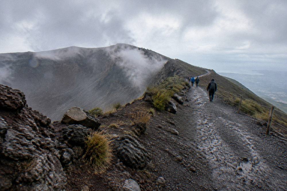
The weather rule deserves respect. When the regional civil protection authority issues an orange alert or higher, the ticket office and the trail close automatically, with refunds issued automatically for slots inside a closure and on request for adjacent slots. It is a sensible system on a mountain where November averages 129 mm of rain and the summit runs 6 to 7 C cooler than Naples in every month of the modelled 1991-2020 climate average. Check the live listing and the forecast the day before, not the week before.
For a lighter-weight entry, the Vesuvius Skip-the-Line Ticket and Multilingual Audio Guide by Askos Tours is a 2-hour, from €22 per person product rated 4.4, though from a small pool of only 35 reviews, with a minimum age of 7 on the listing. The similar Mount Vesuvius Excursion: Skip-Line Ticket and Digital Guide sells from €16 per person and holds a 4.2 from 3,756 reviews. Both hand you the ticket and the interpretation while leaving the transfer to you.
One last thing before you book anything. The crater is not a viewpoint with a railing, it is the mouth of the volcano that last erupted in 1944, walked under supervision, on loose ash, in weather that turns fast. Wear real shoes, carry water, and go in the morning when the cloud is lower and the slots are fresher. The mountain has been patient for eighty years, and it will still be there in the afternoon.
If any of the three formats above fits your trip, the band below collects them one more time for a final comparison before you commit.
Common Questions About The 1944 Vesuvius Eruption
When did Mount Vesuvius last erupt?
Mount Vesuvius last erupted in March 1944. The eruption began on 18 March, intensified on 19 March, and lava reached the towns on the volcano's flanks on 21 March, per the INGV Osservatorio Vesuviano. No eruption has occurred since.
Is Mount Vesuvius still an active volcano?
Yes. Vesuvius is active but quiescent, meaning dormant rather than extinct. The alert level is published as green, the September 2026 bulletin recorded 121 small earthquakes with a maximum magnitude of 1.7, and fumaroles still vent on the crater's inner walls.
What happened during the 1944 eruption?
Explosions on 18 March partly destroyed the small scoria cone inside the crater, activity intensified on 19 March, and lava reached the surrounding towns on 21 March. The eruption then subsided, and the crater settled into the elliptical shape, with a maximum diameter of 580 metres, that hikers see today.
Can you hike to the crater of the last eruption?
Yes, on Trail 5, the Gran Cono. The route is 4,010 metres round trip, takes about two and a half hours, and tops out at 1,175 metres, short of the 1,281-metre summit. Entry is online only, by time slot, and everyone above 1,000 metres is accompanied by the park's volcanological guides.
Is Vesuvius monitored for future eruptions?
Constantly. The Osservatorio Vesuviano runs continuous seismic, geodetic, thermal and geochemical monitoring and publishes a monthly bulletin. The official red zone covers about 700,000 residents across 25 municipalities of the Naples and Salerno provinces who would be evacuated in a future eruption.
What does the crater rim show a hiker today?
The direct aftermath of 1944: an elliptical crater up to 580 metres across, fumaroles releasing volcanic gas on the inner walls, and a turnaround point at 1,170 metres looking down into the vent. The upper rim route itself is closed to the public and reserved for researchers.