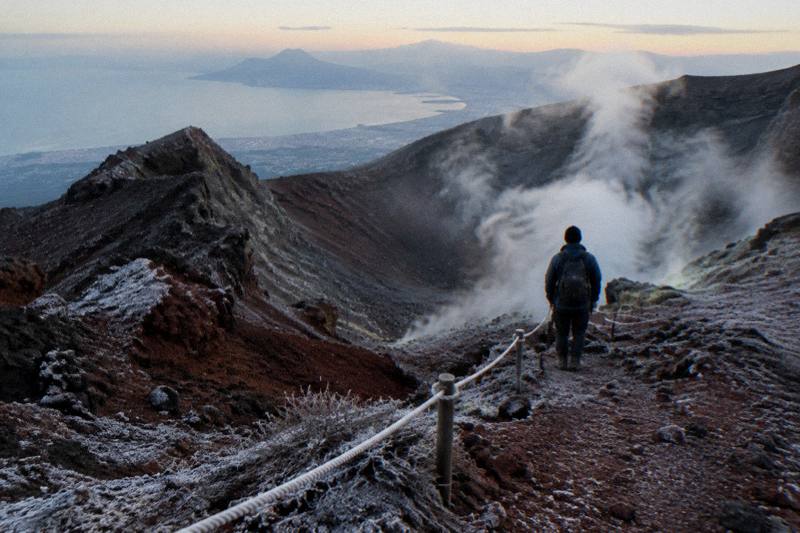
Mount Vesuvius Trail Map And Routes
The only trail the public can walk to the Vesuvius crater is Trail 5, the Gran Cono: 4,010 metres round trip from the Quota 1000 plaza to a turnaround at 1,170 metres. Here is the route point by point, the park's other ten trails, and how to reach the trailhead.
Short answer
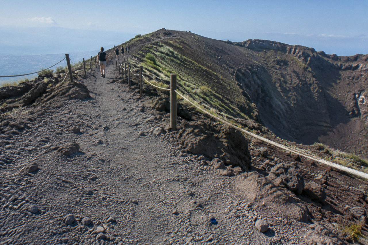
The Vesuvius crater route is Trail 5, the Gran Cono: 4,010 m round trip, about 2 hours 30 minutes, starting at the Quota 1000 plaza above Ercolano. The path passes the ticket hut at 1,118 m and ends at a turnaround at 1,170 m, short of the 1,281 m summit. A park volcanological guide accompanies every visitor above 1,000 m.
The public face of Vesuvius is one path. Trail 5, the Gran Cono, is the only route on the mountain that leads a visitor to the crater rim, and the park runs it under a strict protocol: online timed tickets, 60 people admitted every 10 minutes, and a volcanological guide attached to every group above 1,000 metres. Everything else on the volcano, the other ten numbered trails of the national park, is woodland and lava-flow walking that never touches the crater. A good Vesuvius map therefore has two halves, and this guide draws both: the crater route in detail, point by point, and the wider trail network for anyone with a full day and proper shoes. If the hike to the crater sounds like more than your legs want to give, getting up Vesuvius by 4x4 or e-bike covers the easier ways to reach the rim.
The numbers that matter most come from the park's own trail page. Trail 5 is 4,010 metres round trip, takes about 2 hours 30 minutes, and carries an official difficulty rating of low: the park calls it pending, easy and short. The route tops out at 1,175 metres, well below the summit benchmark of 1,281 metres published by INGV, Italy's national volcanology institute. Visitors do not stand on the true summit, and the upper rim route around the crater edge is reserved for researchers.
Where Does The Mount Vesuvius Crater Trail Actually Start?
The Gran Cono trail starts and finishes at the Quota 1000 plaza, the ticketed staging area at roughly 1,000 metres on the Ercolano side of the volcano. There is no parking at the plaza itself, and no public toilets there for now, so it works purely as a pedestrian gateway: you arrive by shuttle, by tour bus, or on foot from the Quota 800 car park below.
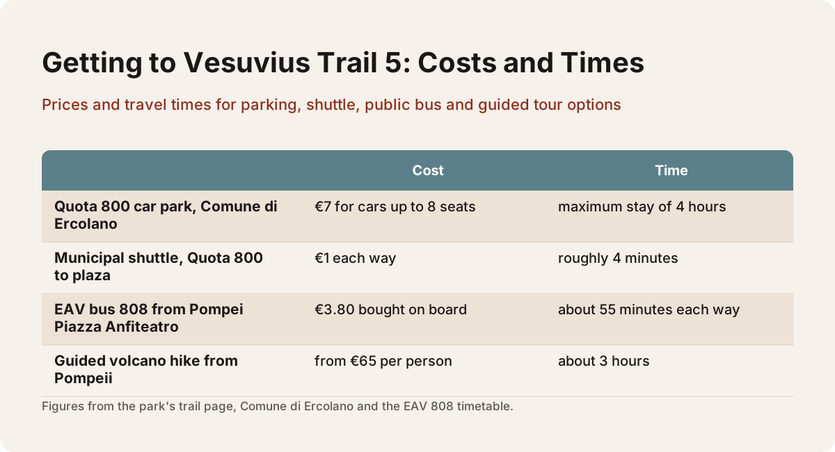
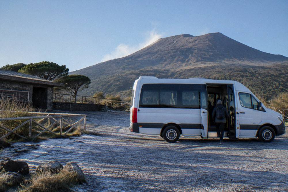
The plaza sits at the end of the access road that winds up from Ercolano. Drivers park lower down at Quota 800, a car park run by the Comune di Ercolano with a maximum stay of 4 hours and a charge of €7 for cars up to 8 seats, then cover the remaining 1.8 kilometres either on foot, about 30 minutes of uphill walking, or on the municipal shuttle at €1 each way, a ride of roughly 4 minutes. The park's own access guidance, published on its Gran Cono page, advises buying any parking permit only after the crater ticket is secured.
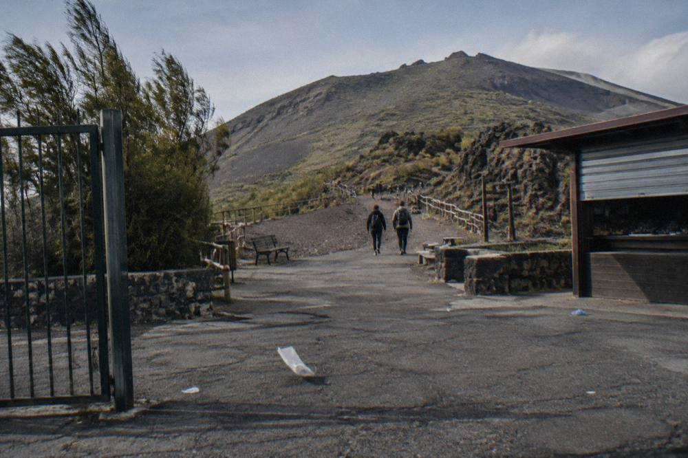
Public transport reaches the same door. The EAV bus 808 runs from Pompei Piazza Anfiteatro up to Quota 1000 nine times a day in each direction, about 55 minutes each way, with departures up the mountain between 8:30 and 14:30 and a fare of €3.80 bought on board. The timetable, published by EAV, shows the last uphill run arriving at 15:25, which lands after the winter last entry, so the bus alone cannot carry a late-afternoon plan in the short months. Anyone weighing the bus against a transfer should also read our breakdown of shuttle options from Pompeii to Vesuvius.
How Long Is The Walk To The Vesuvius Crater?
Trail 5 measures 4,010 metres round trip and the park allows about 2 hours 30 minutes to complete it, though a tour group may not spend more than 2 hours on the shortest out-and-back variant or 3 hours on the longest loop variant. The one-way climb from the Quota 1000 plaza to the turnaround is roughly 2 kilometres, gaining altitude steadily on a wide, dusty, switchbacking path. The official difficulty rating is low.
The walk itself is less a hike than a steady uphill stroll on loose volcanic ash and gravel. The path is wide enough for the park to send groups of 20 up at a time, and the surface is the reason guides repeat one instruction: keep to the right side of the walkway, because descending traffic uses the other line and the ash is slippery under cheap shoes. Millie, a United Kingdom guest who reviewed a Naples day tour that includes the crater, put it plainly: very uneven surfaces, wear trainers, and carry water.
Two timing rules frame any map reading. First, the closing time printed for each month is a last-access time, and the visit must end within one hour of it, so in March and October, with last access at 16:00, the trail effectively empties by 17:00. Second, a normal ticket is valid from 120 minutes before to 120 minutes after the printed slot, which gives a booked visitor a four-hour arrival window rather than a single minute. Our guide on how to hike Mount Vesuvius works through the timing in practice.
The three formats above cover most map-first visitors: a guided hike with transfer from Pompeii, a self-paced transfer with entry tickets, and a plain bus transfer with the park entry fee included. All three are bookable for future dates, and each listing flags free cancellation, so confirm the operator's current schedule when you book.
What Are The Key Points Along Trail 5?
The route has four fixed points: the Quota 1000 plaza at roughly 1,000 m, the ticket hut at 1,118 m, the crater-rim turnaround known as the Capannuccia at 1,170 m, and the path's maximum altitude of 1,175 m. The crater at the top is elliptical with a maximum diameter of 580 metres, and fumaroles steam on its inner walls, visible evidence that the volcano is active, though in a phase of quiescence.
Between the plaza and the hut the path climbs through sparse vegetation on the mountain's southern flank, with the Bay of Naples opening behind you: on a clear day the view runs to Capri and the Sorrento peninsula. Above the hut the landscape turns to bare ash and lava, and the last stretch to the turnaround is the steepest section, though it never requires hands. The turnaround itself is the legal end of the public route; the upper rim path beyond it stays closed to visitors and is used by researchers only.
| Point on Trail 5 | Approximate altitude | Role on the route |
|---|---|---|
| Quota 800 car park | below 1,000 m | Parking, 1.8 km and about 30 minutes below the plaza, or a €1 shuttle ride |
| Quota 1000 plaza | about 1,000 m | Trail start and finish, shuttle and bus stop, no parking |
| Ticket hut | 1,118 m | Ticket check, guided groups form here |
| Capannuccia turnaround | 1,170 m | End of the public path at the crater rim |
| Path maximum altitude | 1,175 m | Highest point a visitor reaches |
| Crater, maximum diameter | 580 m across | Elliptical, fumaroles on the inner walls |
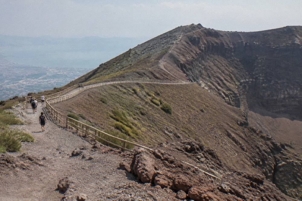
A note on what the top of the path is not. The 1,281 m figure quoted for Vesuvius is the summit height measured by INGV; the trail stops below it by design, so no tour can promise the true summit. Jody S., who reviewed a three-site day trip from Naples, described the payoff anyway: a good hike to the crater with a view of Naples, the countryside, Sorrento and Capri from the turnaround.
For visitors who want the route drawn end to end with a guide on it, the guided volcano hike from Pompeii is the natural pick: an Askos Tours small-group product, from €65 per person, rated 4.8 from 282 reviews, about 3 hours, with transfer and a guided crater walk included. It is the featured tour on this page because it covers exactly the ground this map describes, and the same format is compared in our guide to the crater itself.
What Are All 11 Numbered Trails In Vesuvius National Park?
The park lists eleven numbered trails: 1 Valle dell'Inferno, 2 Lungo i Cognoli, 3 Monte Somma, 4 Riserva Tirone, 5 Gran Cono, 6 Strada Matrone, 7 Vallone della Profica, 8 Trenino a Cremagliera, 9 Il Fiume di Lava, 10 L'Olivella and 11 Pineta di Terzigno. Only Trail 5 reaches the crater. The others cross the Somma ridge, the lava flows and the park's woodlands, and their status changes with maintenance, so check with the park before planning any of them.
This site does not report standing open-or-closed status for individual trails, because the park's maintenance calendar shifts and a page that says open today can be wrong next month. What can be stated as a rule is that Trail 8, the old cog-railway route, and Trail 10, L'Olivella from Sant'Anastasia, appear on the park's own list as not open pending works, and that sections of Trails 2 and 3 toward Somma Vesuviana are affected by closures. Trail 4, Riserva Tirone, is a flat reserve path where bicycles are permitted at a maximum of 20 km/h and dogs are barred because it crosses an integral reserve.
| Trail number | Name | Character of the route |
|---|---|---|
| 1 | Valle dell'Inferno | Valley route on the north flank, woodland and ravines |
| 2 | Lungo i Cognoli | Ridge path along the Somma crest, partly affected toward Somma Vesuviana |
| 3 | Monte Somma | The ancient Somma rim, partly affected from the Somma Vesuviana side |
| 4 | Riserva Tirone | Flat reserve path, about 2.6 km, bikes permitted at max 20 km/h, no dogs |
| 5 | Gran Cono | The crater route, the only trail to the rim, ticketed and guided |
| 6 | Strada Matrone | Historic track through the park's western woodland |
| 7 | Vallone della Profica | A gully route on the seaward slopes |
| 8 | Trenino a Cremagliera | The old cog-railway line, listed as not open pending works |
| 9 | Il Fiume di Lava | A path over the 1944 lava flow |
| 10 | L'Olivella | A roughly 3.7 km low-difficulty route from Sant'Anastasia, listed as not open pending works |
| 11 | Pineta di Terzigno | Woodland trail through the Terzigno pine forest on the east side |
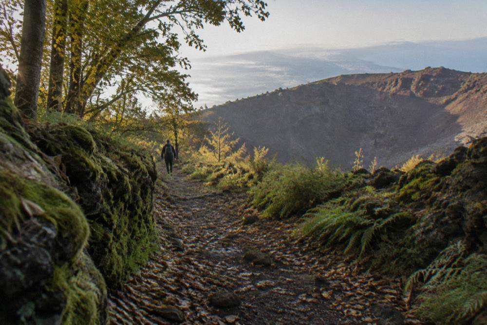
For a first visit the choice is rarely between trails, it is between the crater and everything else. The blog post Is It Worth Going Up Mount Vesuvius? answers that directly for the crater route, and the wider network is best treated as a second-day option for visitors staying nearby. Anyone deciding between the crater walk and a full guided day can also compare the formats in our guide to the best Vesuvius tours.
How Do The Trail Hours And Daily Caps Change Through The Year?
Crater access opens at 09:00 every month and the last-access time moves with the season: 15:00 in January, February, November and December, 16:00 in March and October, 17:00 in April, May, June and September, and 18:00 in July and August. The daily cap moves too, from 2,160 visitors in the winter months to 3,240 in July and August. The visit must end within one hour of last access.
The caps are not decoration, they are the reason a timed ticket exists. Admission runs at a maximum of 360 hikers per hour, 60 people every 10 minutes in three groups of 20, and tickets are sold online only, by 10-minute slot, released 30 days ahead. When a day sells out, a last-minute release of 10 named tickets per slot appears 30 minutes before each slot, buyable only over the wifi near the entrance, with a maximum of 5 per email address. The full index of guides sits on Mount Vesuvius Tours.
| Months | Last access | Daily visitor cap | Summit high, modelled 1991-2020 average |
|---|---|---|---|
| January, February | 15:00 | 2,160 | 5.6 to 6.0 C |
| March | 16:00 | 2,520 | 8.3 C |
| April, May, June | 17:00 | 2,880 | 11.1 to 19.2 C |
| July, August | 18:00 | 3,240 | 22.1 to 22.8 C |
| September | 17:00 | 2,880 | 18.7 C |
| October | 16:00 | 2,520 | 14.8 C |
| November, December | 15:00 | 2,160 | 6.7 to 10.4 C |
One closure rule applies in every month and deserves its place on any map: the ticket office and the trail close automatically on any day the regional Civil Protection authority issues an orange weather alert or higher. Tickets inside a closure are refunded automatically; slots adjacent to a closure are refundable on request within 30 days, with refunds processed within 60 days. No standing statement about any specific closure belongs on a page like this, so check the operator's listing and the park's channels for the day you plan to walk.
Do You Need A Guide On The Vesuvius Summit Path?
Yes, in a specific sense: above 1,000 metres every visitor is accompanied by the park's volcanological guides, the Presidio Permanente Vulcano Vesuvio, attached to each group, so no one walks the crater section alone regardless of how they booked. A commercial tour guide adds a different layer, commentary, logistics and transfer, on top of the mandatory park accompaniment. Independent visitors still get the park guide at the trailhead.
This is the detail that reshapes the guided-versus-solo decision. Buying a bare ticket does not mean an unguided walk; it means the park's own guide walks your group up and down. What a paid tour adds is everything around the trail: the timed ticket handled for you, the transfer from Pompeii or Naples, and a guide who explains the 1944 eruption and the AD 79 destruction of Pompeii rather than only the path itself. Melanie, a United States reviewer of a Naples day tour, praised exactly that layer: a knowledgeable guide who explained the history of Pompeii well, with Vesuvius good as well.
The price gap between the two approaches is wide but legible. A bare transfer-plus-ticket product from Naples, the direct transfer with guaranteed entry, runs from €35.10 per person and is rated 4.4 from 1,785 reviews; Mia from the United Kingdom reviewed it as a great way to explore the crater at her own pace. The guided three-hour hike from Pompeii costs from €65 per person. Our comparison of guided versus self-guided options works through the trade-offs line by line.
For visitors starting in Pompeii rather than Naples, the same self-paced format exists there too, and it is the one most map readers should shortlist: transfer up, ticket in hand, walk with the park's guides, transfer back. Nicola from the United Kingdom reviewed the Pompeii bus transfer with park entry included as an easy, well-organised way to get to Vesuvius and back, with a drop-off at Pompeii station or the original meeting point.
Which Tours Follow The Crater Route From Pompeii?
Pompeii is the densest trailhead base for the Gran Cono, with three main formats: a guided hike with transfer from about €65 per person, a transfer-plus-entry-ticket product from about €35.10 per person, and a bus transfer with the park entry fee included, also from €35.10 per person. All three put you at the Quota 1000 plaza, so the trail experience is identical; what differs is the guidance, the group size and the inclusions.
The guided option, run by Askos Tours, is rated 4.8 from 282 reviews and carries an expert hiking guide up the path alongside the park's mandatory accompaniment. The two transfer products, one by Around Vesuvio and one by MOTORENT, are rated 4.1 to 4.4 from review pools between 551 and 1,785, and suit visitors who want the crater but not a commentary. A step up in format, the small-group excursion from Naples with flexible timing, adds Pompeii to the day from €105 per person.
| Format from Pompeii | From price | Rating and pool | What it covers |
|---|---|---|---|
| Guided crater hike with transfer | €65 per person | 4.8 from 282 reviews | Transfer, guided walk, about 3 hours |
| Transfer with entry tickets | €35.10 per person | 4.4 from 1,785 reviews | Transfer, entry, self-paced walk |
| Bus transfer with park entry fee | €35.10 per person | 4.3 from 1,923 reviews | Round-trip bus, entry included, 3 hours |
| Hike and tour by bus | €35.10 per person | 4.1 from 213 reviews | Bus from Pompeii, entry, 3 hours |
Every one of these products is bookable for future dates and each flags free cancellation on its listing, so the practical advice is to book the timed format early and confirm the operator's current schedule closer to the day. Ticket mechanics are covered in depth in our guide to Vesuvius tickets and entry, including what a bundled entry actually includes.
How Do You Get To The Trailhead Without A Tour?
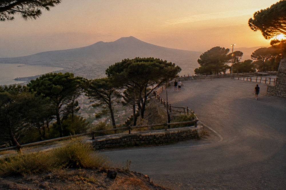
Driving from Naples, take the A3 Napoli-Salerno to the Torre del Greco exit, then the SP144 to the Quota 800 car park, about 15 minutes and 7.3 km from the motorway. From Quota 800, cover the 1.8 km to the plaza on foot in about 30 minutes or take the €1 municipal shuttle. By public transport, the Circumvesuviana to Ercolano Scavi or Pompei-Villa dei Misteri connects to shuttles or the EAV 808 bus.
The car option carries two cautions worth printing on the map. First, a traffic ban applies on Via Osservatorio between Quota 800 and Quota 1000 at set hours, reserved for scheduled buses, taxis, licensed cars and goods vehicles, so private cars park at Quota 800 and no higher. Second, the parking is municipal, run through the Comune di Ercolano's parking system, with the 4-hour maximum stay, and the park advises sorting parking only after the crater ticket. Train fares on the Circumvesuviana are not stated here: check the operator's fare lookup before you travel.
Cruise passengers and Sorrento-based visitors face the same last-mile problem from different ends. From the Naples port, shore excursion products bundle the crater and Pompeii in a single day, from about €129.73 per person with lunch included. From Sorrento, the practical route runs by train or tour minibus through Pompei. This site's own planning pages, starting from the Mount Vesuvius tours homepage, map each departure city against the products that actually run from it.
What Should You Check On A Vesuvius Map Before You Walk?
Three things decide whether your map translates into a good day: the last-access time for your month, because it moves four times a year; the weather alert level, because an orange alert or higher closes the trail and box office automatically; and your ticket slot, because the 120-minute window on either side of it is your real arrival deadline. Everything else on the route, the plaza, the hut, the turnaround, is fixed and cannot change.
The fixed geography is the comfort here. The path is the same in every season, the guide accompaniment above 1,000 metres is mandatory in every season, and the turnaround at 1,170 metres is the end of the line for every visitor, on every tour, in every year. The variable parts, hours, caps, alerts and ticket releases, are all published by the park and all checkable in minutes. A visitor holding a timed ticket and a weather forecast has effectively already walked the route on paper.
For the deeper background, the questions of what the volcano is doing and whether it might erupt again are answered with the monitoring record: green alert level, September's 121 small earthquakes at a maximum magnitude of 1.7, and a long-term decline in hydrothermal activity in the crater. The last eruption remains March 1944, when lava reached the towns on 21 March. None of it changes the map, but it changes how the fumaroles at the turnaround read.
Common Questions About The Mount Vesuvius Trail Map
How long is the Mount Vesuvius crater trail?
Trail 5, the Gran Cono, is 4,010 metres round trip and takes about 2 hours 30 minutes. A tour group may not exceed 2 hours on the shortest out-and-back variant or 3 hours on the longest loop variant under the park protocol.
Where does the Vesuvius trail start?
At the Quota 1000 plaza above Ercolano, at roughly 1,000 metres. There is no parking at the plaza; drivers park at Quota 800, 1.8 km and about 30 minutes below, or take the €1 shuttle each way.
Do you reach the summit of Vesuvius on the trail?
No. The path tops out at 1,175 metres and the public turnaround sits at 1,170 metres, while the summit benchmark is 1,281 metres per INGV. The upper rim route beyond the turnaround is reserved for researchers.
How many trails are in Vesuvius National Park?
Eleven numbered trails, of which only Trail 5, the Gran Cono, reaches the crater. The others cross the Somma ridge, lava flows and woodland, and their status changes with maintenance, so check with the park before planning them.
Can you walk the Vesuvius crater trail without a guide?
Every visitor above 1,000 metres is accompanied by the park's volcanological guides, so no one walks the crater section alone. A commercial tour adds commentary and transfer on top of that mandatory accompaniment.
When does the Vesuvius trail close each day?
Last access is 15:00 from November to February, 16:00 in March and October, 17:00 from April to June and in September, and 18:00 in July and August. The visit must end within one hour of last access, and the trail closes automatically on orange weather alerts or higher.